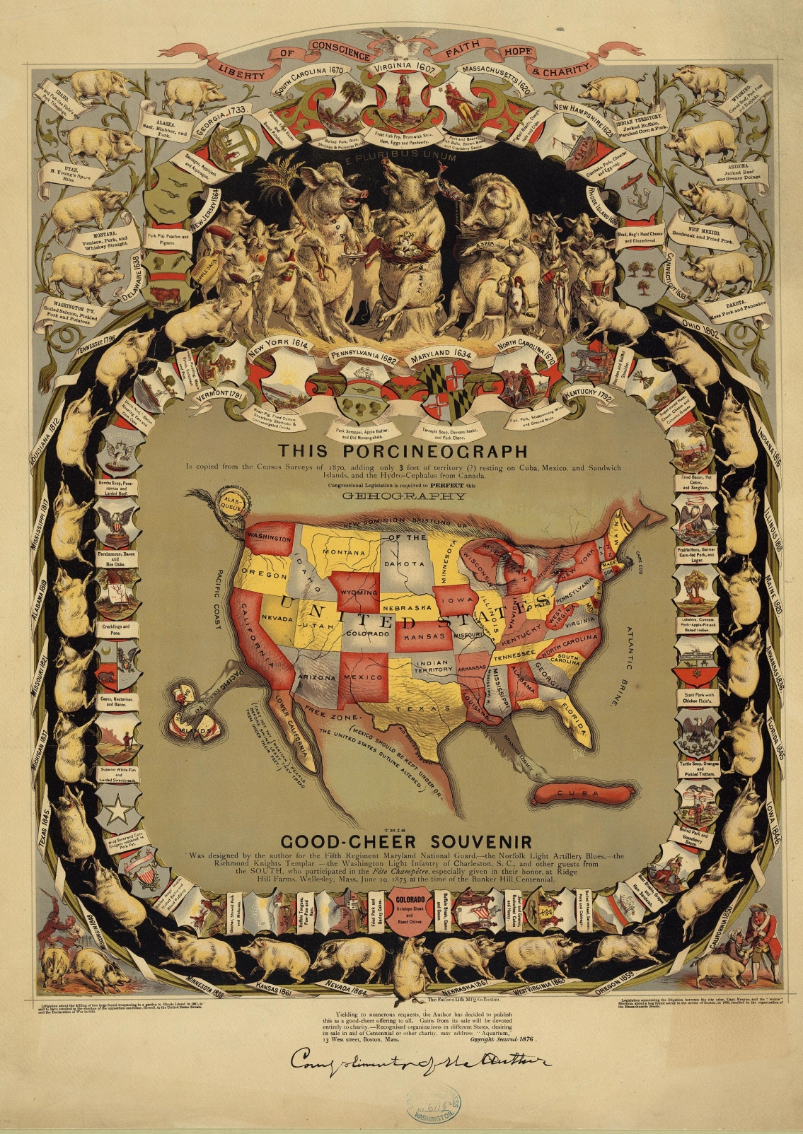
This Porcineograph (1876)
This Porcineograph is a 19th century map of the United States, in shape of a pig. Created by William Emerson Baker, this peculiar map was made as a memorabilia for visitors at his Ridge Hill Farm. Baker uses the different crests of every state of the Union as the border for this hog-map, along with local cuisine that involves pork goods. Digitized by the The Library of Congress.
Specifications
Published by
Forbes Lithograph Manufacturing Company of Boston
Infographic Elements
map, illustration
Forbes Lithograph Manufacturing Company of Boston
Infographic Elements
map, illustration


![So You Want To Watch Youtube [Flowchart]](https://149842070.v2.pressablecdn.com/wp-content/uploads/2016/03/Youtube-Flowchart-Infographic-150x150.jpg)